-
ARTISTS
KACPER KROPACZ
MARCIN KULABKO
MELANIE GANDYRA
JULIA BORZUCKA
JOLA WÓJCIK
ALEKSANDRA TUBIELEWICZ
ANGELIKA GALUS
ZBYSZKO OLEŚ - WOLLENBERG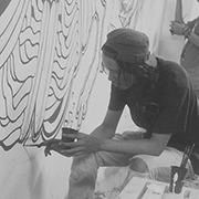
YUDA ARLIANDI
KACPER DUDEK
PAWEŁ ZAKRZEWSKI
TOMASZ ZACZENIUK
CHINTAMI RICCI
AGNIESZKA ŻYLIŃSKA
MIREK ZAŁĘSKI
PIOTR BANAK
AGNIESZKA STANASIUK
AGA SIWCZYK
MICHAŁ JANDURA
WALDEK BOROWSKI
MAŁGORZATA MARCZUK
ALICJA POSŁUSZNA
ANGELIKA KORZENIOWSKA
MONIKA WYŁOGA
MICHAŁ OSTANIEWICZ
MICHAŁ TROJANOWSKI
AGATA WIERZBICKA
MARTA PIECZONKO
JAN ASTNER
MAREK MIŚ
JOANNA BOROWIEC
PAULINA KORBACZYŃSKA
KASIA DOMANSKA
ANNA KORDOWICZ-MARKUSZEWSKA
MARIA SOSNOWSKA
MAREK PALIŃSKI
ROKSANA KULARSKA KRÓL
JOLANTA MIKUŁA
ZOFIA ASA
ALICJA KAPPA
KATARZYNA BRECZKO
DOROTA JANICKA
KATARZYNA JURCZENIA
ELŻBIETA OWCZAREK
HUBERT KOŁODZIEJSKI
ERUDA ART
ANDRZEJ TUŹNIK
KRZYSZTOF OWEDYK
OLA LIS
EMILIA DZIUBAK
IRYNA BENDEROVSKA
MAREK TURKOWSKI
LESZEK BUJNOWSKI
JUSTYNA BRZOZOWSKA
WERONIKA MARSZELEWSKA
DOROTA RUCIŃSKA
MARCEL WOJDYŁO
JANUSZ DZIURAWIEC
PATRYCJA WARZESZKA
MARCIN SACHA
ANNA BRZESKA
BARBARA GIBSON
MAGDALENA KACZMARCZYK
AGA PIETRZYKOWSKA
SYLWIA STRUGALA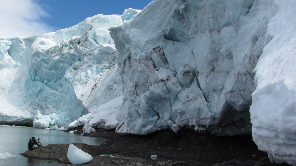
WOJCIECH WALKIEWICZ
IWONA WIERKOWSKA-ROGOWSKA
L.TADEUSZ SERAFIN
MAGDALENA MURASZKO-KOWALSKA
ANNA RUDAK
ALIAKSANDR KANAVALAU
KARINA JAŹWIŃSKA
ALEKSANDER LASZENKO
MALWINA DE BRADE
ANNA GROCHOWSKA
MARIA DEK
JAGA KARKOSZKA
NIKOLA KUCHARSKA
ALEXEY ESAULENKO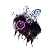
ROKSANA ROBOK
EVA CYGANSKA
TYTUS BRZOZOWSKI
NATASZA MIRAK
LIDIA SNITKO-PLESZKO
KATARZYNA WOŁODKIEWICZ
PETRELA KUŹMICKA
ANDRZEJ SZATYŃSKI
EUGENE SOLOVIEV
HANNA GĄSIOROWSKA
MAREK GUBERMAN
JOANNA RUSINEK
AGATA KOSMALA
MAŁGORZATA BAŃKOWSKA
ANDREA BENETTI
ANDREA DEMÉNY
JOWITA PIOTROWSKA
ZOSIA JEMIOŁO
GRZEGORZ SZYMA
ALEKSANDRA REY
MONIKA EKIERT JEZUSEK
HENADZY HAVARTSOU
KAROLINA KUCHARSKA
LILI FIJAŁKOWSKA
ANNA WOJCIECHOWSKA-PAPROCKA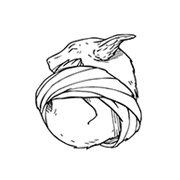
MAŁGORZATA WYSOCKA-KIBART
KASIA ŁUBIŃSKA
ANNA KAMIŃSKA
MAREK DZIENKIEWICZ
KATARZYNA BOGDAŃSKA
AGNIESZKA KOZIEŃ
AGNIESZKA NAWRAT
MICHAŁ MILDE
TOMEK LAREK
JAROSŁAW FILIPEK
KATARZYNA JELIŃSKA
PIOTR PIECKO
ANDREA VARE
MICHAŁ KARCZ
SYLWIA GORAK
NELINA TRUBACH-MOSHNIKOVA
ELICIA EDIJANTO
MARTA JULIA PIÓRKO
JOANNA K JURGA
SŁAWOMIR CHRYSTOW
LAURA WASILEWSKA
JOANNA NYKIEL
DOROTA KRAFT
PIOTR ZIMNIAK
DORINA MACIEJKA
MARCIN GOLONKA
MATYLDA KONECKA
MAŁGORZATA GOCZEWSKA
RESATIO ADI PUTRA
MAGDALENA PASTUSZAK
GABRIELA GIEGIEL
ANNE PLAISANCE
TOBING DEWI
KATARZYNA ŚWIĘTOCHOWSKA
LAURA RUMI
TOMASZ HANKUS
MARCIN MINOR
BOŻENA CZERSKA
JACEK MALINOWSKI
- ARTSTORE
- BLOG

ELŻBIETA OWCZAREK. TAKE A PAUSE. PAINTED WITH LIGHT.
EXHIBITION OF PAINTINGS BY TYTUS BRZOZOWSKI 2017.
AFTER SEEING EMILIA’S DZIUBAK ILLUSTRATIONS YOU WON’T LOOK AT INSECTS THE SAME WAY.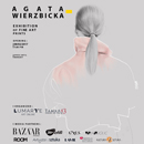
AGATA WIERZBICKA ● EXHIBITION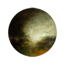
ETUDES. KAROL PROCHACKI’S ART EXHIBITION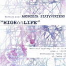
HIGH ON LIFE! ANDRZEJ SZATYŃSKI EXHIBITION.
INTERVIEW WITH THE ARTIST - ROKSANA KULARSKA - KROL
NATURA NIHIL FRUSTRA FACIT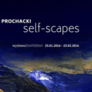
EXHIBITION OF PAINTINGS BY KAROL PROCHACKI
KAROL PROCHACKI PAINTING. EXHIBITION 17.10.2015
TYTUS BRZOZOWSKI - PAINTING. EXHIBITION 09.10.2015
- ABOUT US

2014-03-15
Living Carthography Vatnajökull Nationalpark 2010
The installation is the central element of the exhibition in the eastern Visitor Centre of the Icelandic Vatnajökull National Park. A dynamic map provides information on the specific flora, fauna and geology of the region, providing visitors with a general overview and orientation.
The basic floor space of the installation is a stylised 3D landscape of the terrain surrounding the volcano Snaefell. A topographical map is projected onto the polygonal space showing how the region changes through the seasons, providing a lively background to the information graphics. The scenario is rounded off with the relevant atmospheric sounds.
Information on the area's vegetation, animal world and geological characteristics is provided by an interactive legend for each topic. Additional graphics and animations on various aspects can be displayed at the press of a button, for example showing reindeer paths and the distribution of rare plants. These can then be visualised directly in the 3D map, changing with the seasons.
The graphics are accessible in all three legends simultaneously. The combination of these allow visitors to discover connections between the topics – for example that the nesting grounds of the whooper swan are situated in areas where special types of grass grow. Since the legends are placed around the installation, visitors stand opposite each other and are encouraged to engage in discussion.
EVENTS